
SriLankaView by www.srilankaview.com The Virtual Traveller to SriLanka
SriLankaView by www.srilankaview.com The Virtual Traveller to SriLanka
Ritigala

Ritigala is a range of mountains which is near to Anuradhapura in the dry zone of Sri Lanka. It is about 42 km from Anuradhapura and can be reached passing Maradankadawala and turning off at Ganewelpola along Anuradhapura-Habarana highway.Ritigala Nature Reserve is one of the three strict nature reserves in Sri Lanka and is about 5 Sq. km in land extent.
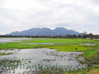
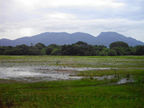
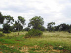
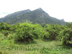
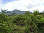
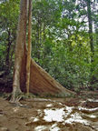
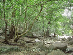
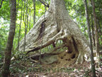
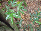
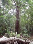
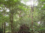
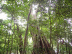
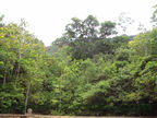
Ritigala mountain range rises abruptly 2000 feet from the surrounding terrain which is about 500 feet above sea level .There are several peaks in the range and the highest peak is the Ritigala. Kodigala or the Flag Rock is the highest point (of Ritigala Peak) in this mountain range and is of a height of 2514 feet. It is also the highest elevation between the Central Hills of sri Lanka and the South Indian mountain ranges. This mountain range comprises three types of forests.The bottom part of the mountain range is Dry Mixed Evergreen Forest type,the middle part of the range is Tropical Montane Forest type and the highest terrain of Upper Montane Forest type. The mountain summits attract more rainfall than the surrounding areas and amidst dry weather at lower plains, the peaks get cladded with clouds and mist lowering the temperature at the summits.
Historically, this has been called as Arittha Pabbatha (the mountain of Aritta) which can be translated as 'Dreadful Rock' or 'Safety Rock' or even 'Riti trees' growing upon it. Around 3rd Century BC, Aritta , who was the Chief Minister of King Devanampiyatissa, who later was ordained as the First Sri Lankan Monk and became an Arahath, spent his monastic life at Ritigala.
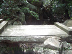
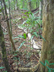
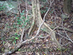
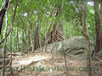
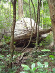
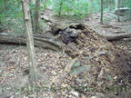
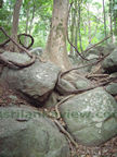
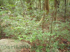
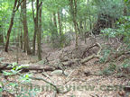
There are many monastic ruins of stones, terrace ways, circular terraces, a stone bridge, and remains of a giant stone banked pond built across a water stream of the earlier Monastery Complex.
To enter a Strict Nature Reserve, one needs prior permission obtained from the Forest Department but since the Archeological Department has allowed visitors to Ritigala to sight see around 60 acres of this prime Ecological wonder in the dry zone inside the forest land, strewn with archeological remains, one can have a glimpse of this wonderful and mystic Strict Nature Reserve , not found anywhere else in the island.
This series of Photographs will take you on a tour from Anuradhapura - Habarana highway right up to a mid point of the Ritigala mountain of Anuradhapura District, allowing to tramp for the visitor with scattered ancient building remains in the forest land.
Since this area is frequented by wild elephants, mostly during latter parts of the day, it is advised to visit Ritigala in the mornings.
Click on Thumbnail Photos to see full size image and the photo description.
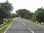
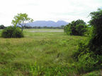


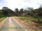


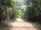
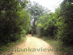
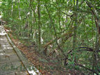
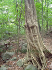
Travelling to Ritigala the easiest way is to proceed from Anuradhapura or Habarana. Turning inside near Ganewalpola, the distance to the Archeological Site entrance is about 9 kms. Going deep inside , one finds the Dry Mixed Evergreen Forest surrounding that is home also to some herds of elephants. A clear view of the mountain range greets the visitor while proceeding along the road. Dry season is the best to visit Ritigala Mountains.
Click on Thumbnail Photos to see full size image and the photo description.

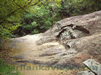
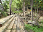


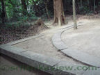
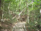
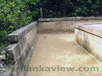
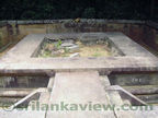
After arriving at the site, there is a car park and an Archeology Office near by. From there , you have to make your way up amidst the ruins about a distance of 2000 feet and 600 feet up on the Ritigala mountain. First you come across a huge man made [ now abandoned and ruined ] pond called ' Banda Pokuna' [ or the ' Made up pond' ]. This is said to be of a capacity to hold about 2 million gallons of water when in use at earlier times.
Click on Thumbnail Photos to see full size image and the photo description.


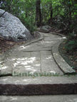


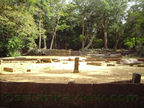


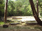


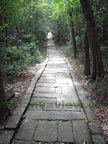


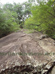
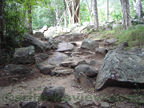
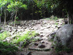
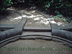
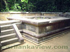
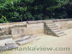
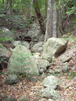
Along the edge of the Pond, starts the path leading to the ruins. There is a stone stairway which leads to the first stone roundabout of the three one comes across. Near the ruins of buildings leads other paths to some more ruins of interest.The beginning of the paved stone path about 5 feet wide with stone ridges at sides through out its length with nicely curved paths , can be accessed from here.
Click on Thumbnail Photos to see full size image and the photo description.


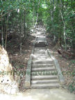


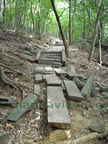
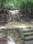
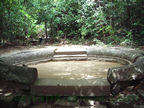
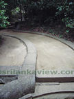
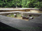
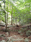
The second and the largest roundabout is found after proceeding along the pavement. Passing it and proceeding further, brings one to the Third stone roundabout.
Click on Thumbnail Photos to see full size image and the photo description.


Click on Thumbnail Photos to see full size image and the photo description.


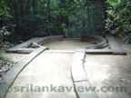
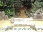
Here is the uppermost point of the Archeological remains the visitor is supposed to find. There are many more ruins scattered along the mountain, but out of bound to the visitor since special permission needs to be obtained from the Forest Department.
Click on Thumbnail Photos to see full size image and the photo description.


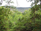
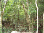
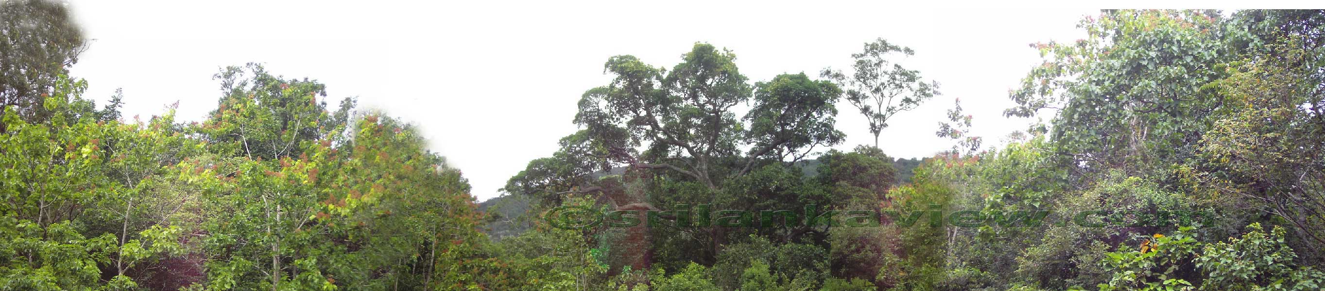
The Panoramic Forest Landscape
Click on Panoramic Thumbnail Photos to see enlarged image. When it appears in a new page, click again on the image to see the full size image.

Nearly 360 Degree Landscape near a Dried up stream. [Image Size- 729 kb]

Nearly 300 Degree Landscape near the ruins. [Image Size- 758 kb]

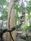
Creeper and Rock Boulder Landscape. [Image Size- 392 kb]
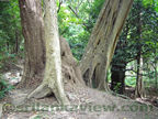
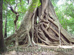
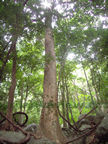
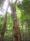
Majestic Forest Trees [Image Sizes- (a) 296 kb, (b) 265 kb, (c) 244 kb, (d) 142 kb ,(e) 327 kb


Landscape view from the topmost Monastery Ruins. [Image Size- 293 kb]

Landscape view from 'Benda Pokuna' area . [Image Size- 364 kb]
--------------- ----------- --------Reference -- ------------- --------------
Central Cultural Fund - " Ritigala"