The
Knuckles Massif Maps

There
are Two Massifs found in Sri Lanka, namely the Knuckles Massif and
the Rakwana Massif which is home to the Sinharaja Forest. The Knuckles
Massif is the most prominent out of the two. A Massif is a part of
the earth's crust confined with faults and shifted to form peaks of
a mountain range. The Knuckles Mountain Range consists with a Main
Range and about four more sub ranges. The Main range can be seen distinctively
from Kandy area, the section which resembles a clenched fist is familiar
to many. The Knuckles Peak [6112 ft] is one of those seen in the clenched
fist like peaks.
Since
Knuckles Mountain Range became a World Heritage site in July 2010,
the interest to learn about the Knuckles area rekindled with many
would be visitors in future to Knuckles. This page will enlighten
the visitor with geographical details of the Knuckles Massif and the
Mountain Range. Some interesting Maps are presented here which are
hard to come across.
Panoramic view of the Northern
Knuckles Range

Click
on Panoramic Thumbnail to see full size image [850 kb ]
Clicking
the above thumbnail [made by combining 7 Photos] will open a Panoramic
landscape view of the Knuckles Mountain Range seen from the top of
Pitawela Pathana [ Mini World's End].
Considering
the whole island geographically, it can be said that there are three
main plains [peneplains]. The first or the lowest is the land mass
of up to 400 feet or less, where the mean value can be said to about
100 feet.
The middle
peneplain is to a height of around 1000 feet but in some places it
may be around 2500 feet.
The highest
plain is on average to a height of around 5000 to 6000 feet from the
sea level, where you find the highest mountains of the island.
See the
following map to have an idea of the Central Hill country and the
southern part of the island. Here you can see the placements of Rakwana
Massif and Knuckles Massif, both are being landmarks of World Heritage
Sites. The PDF file views can be magnified to see detailed selections.
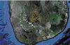 Location
of Knuckles Mountain Range [File size- 89 kb]
Location
of Knuckles Mountain Range [File size- 89 kb]
Exploring
the areas near to Knuckles Mountain Range, here one will see the interesting
geological locations of Wild life sanctuaries or National Parks of
Wasgomuwa,Galoya and Maduru Oya.
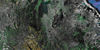 Knuckles
and the National Parks nearby [File size- 258 kb]
Knuckles
and the National Parks nearby [File size- 258 kb]
The
more detailed region identifications are included in this map in which
you will see the River Mahaweli bordering the Southern part of the
Knuckles Massif and then turning Noth almost 90 degrees and running
at some distance to Knuckles' Eastern escarpements.
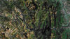 Knuckles
Mountain Range and the Mahaweli River [File size- 129 kb]
Knuckles
Mountain Range and the Mahaweli River [File size- 129 kb]
The
Northern part of the Knuckles mountain range and the areas of Riverston,
Pitawela patana [Grassland], The Mini World's end can be identified
here.
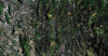 Knuckles,
Pitawela Grasslands and Mini World's End [File size- 126 kb]
Knuckles,
Pitawela Grasslands and Mini World's End [File size- 126 kb]
The
Main Peaks of the Knuckles Mountain range is identified here and the
terrain can be closely looked at.
 Main Peaks of Knuckles
Range [File size- 67 kb]
Main Peaks of Knuckles
Range [File size- 67 kb]
The Knuckles
Massif contains several Mountain Ranges. The main range runs from
North West to South West and three sub ranges parallel to each other
from South West to North East direction originating from the Main
Knuckles Range. The accompanying map shows the four mountain ranges
of the Knuckles.
 Main Range and Sub Ranges
of Knuckles [Image size 226 kb]
Main Range and Sub Ranges
of Knuckles [Image size 226 kb]
A section
of the Knuckles Mountain Range with Peaks identified and to a larger
scale is prepared based on the Sri Lanka Survey Department's 1"
to 1 Mile Ragala Map.
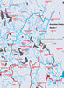 Peaks of Knuckles
Mountain Range - Map #1 [Image size 537 kb]
Peaks of Knuckles
Mountain Range - Map #1 [Image size 537 kb]
Page
Up
References-
Cooray
P.G. The Knuckles Massif-A Portfolio
Cooray
P.G. The Geology of Sri Lanka
 SriLankaView__by
srilankaview.com
The Virtual Traveller
SriLankaView__by
srilankaview.com
The Virtual Traveller 


