
SriLankaView by www.srilankaview.com The Virtual Traveller to SriLanka
SriLankaView by www.srilankaview.com The Virtual Traveller to SriLanka
Knuckles Mountain Range ... continued

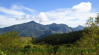
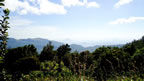
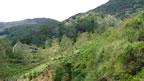
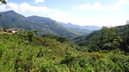
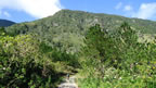
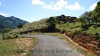
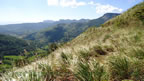
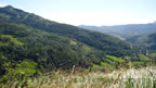
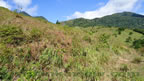
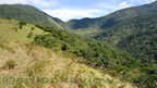
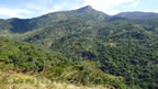
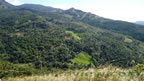
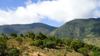
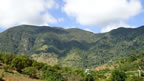
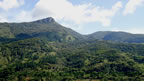
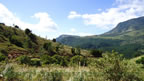
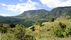
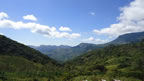
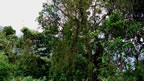
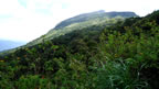
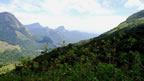
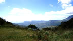
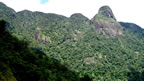
Visiting the Deanston Conservation centre and having a facinating view of the Dotalugala and the Mini Worlds End,one can travel along the road leads to Corbets Gap. This is a very famous place in Knuckles Mountain range. This is a deep vally between Knuckles Mountain range and also a rain shadow area. This area also has a mixture of vegetation types such as wet , dry and montane type. At Corbet's Gap, there is a high wind blow during some months of the year and the forest trees grown in that area has a special feature , that is stunted and gnarled. Looking towards the Corbet's gap from Deanston Mini World's end will give the visitor the panoramic view of Aliyawetunaela and Kinihirigala mountains to the left and the Dumbanagala mountain to the right.
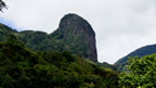
Corbet's Gap Latitude, Longitude 7.373521,80.846694- Elevation-1127 meters (3698 feet) *

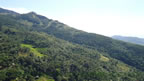
A Corbet's gap Panoramic View

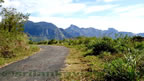
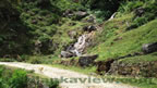
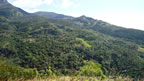
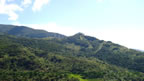
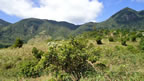
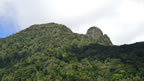
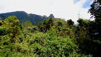
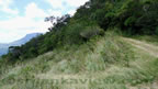
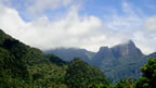
Proceeding from the Corbets Gap View point on the main road towards Loolwatte, one come across this awe-inspiring rock of Sphinx.The area is studded with mound shaped rocks that juts out from the ridges of mountains which has a characteristic of a square shapes on them.
Sphinx Rock Latitude, Longitude 7.373065,80.828726 -Elevation-1607 meters (5273 feet) *
Click on Thumbnail Photos to see full size image and the photo description.


Click on Thumbnail Photos to see full size image and the photo description.


Click on Thumbnail Photos to see full size image and the photo description.


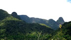


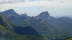


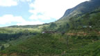
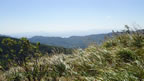
There are nine peaks over 1220 Mts. or 4000 Ft. in Knuckles Range. The highest peak, "Gombaniya" is 1906 Mts. or 6248 Ft. high. The main water streams starting from Knuckles range are Mimure Oya, Kalu Ganga and Kote Ganga. Rainfall annually varies from about 2540mm [100 inches] on Eastern side to 5080mm [ 200 inches] for mid mountain range. Maximum rainfall is during October-January and minimum rainfall from February to September.There is dry weather and sunshine from February to April.
Note- * The Elevations for Corbet's Gap based approximately on the position of the One Inch Map of Surveys Dept.
References-
Cooray P.G. The Knuckles Massif-A Portfolio